Best time to cruise · Good time to go
Norwegian Fjords cruises in May
May 17, Constitution Day, fills Bergen, Ålesund and Oslo with children’s parades and people in traditional bunad costume, though most shops close. Snowmelt sends waterfalls such as the Seven Sisters roaring, mountain roads to viewpoints like Dalsnibba usually reopen and the midnight sun returns to the North Cape mid-month.
- Good time to go
- Avg high 53°F
- 18 hrs daylight
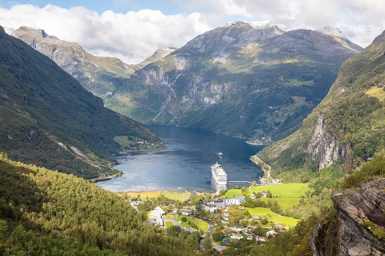
Photo: Diego Delso, CC BY-SA 4.0, via Wikimedia Commons
Norwegian Fjords in May: Good time to go
May 17, Constitution Day, fills Bergen, Ålesund and Oslo with children’s parades and people in traditional bunad costume, though most shops close. Snowmelt sends waterfalls such as the Seven Sisters roaring, mountain roads to viewpoints like Dalsnibba usually reopen and the midnight sun returns to the North Cape mid-month.
Across Norwegian Fjords cruise ports, May brings average highs around 53°F (11°C) and lows near 43°F, with about 3.9 inches of rain over the month and roughly 18 hours of daylight.
- Verdict
- Good time to go
- Season
- May to September for fjord cruises; coastal voyages and northern lights sailings year-round
- Average high / low
- 53°F / 43°F
- Rainfall (month)
- 3.9 in
- Daylight
- About 18 hours
- Typical cruise length
- 7 nights for the southern fjords; 12–14 nights to the North Cape; 12-day coastal round trips
What to pack: layers you can add and remove: long pants, a warm fleece or sweater, a waterproof jacket and closed walking shoes.
How May compares with the rest of the year
- Jan: Shoulder season
- Feb: Shoulder season
- Mar: Shoulder season
- Apr: Shoulder season
- May: Good time to go
- Jun: Best time to go
- Jul: Best time to go
- Aug: Best time to go
- Sep: Good time to go
- Oct: Shoulder season
- Nov: Shoulder season
- Dec: Shoulder season
- No regular sailings
- Shoulder season
- Good time to go
- Best time to go
Norwegian Fjords weather in May
| Month | Jan | Feb | Mar | Apr | May | Jun | Jul | Aug | Sep | Oct | Nov | Dec |
|---|---|---|---|---|---|---|---|---|---|---|---|---|
| High °F (°C) | 351 | 352 | 384 | 447 | 5311 | 6016 | 6418 | 6418 | 5815 | 499 | 415 | 373 |
| Low °F (°C) | 28-2 | 28-2 | 30-1 | 351 | 436 | 5110 | 5412 | 5412 | 5010 | 426 | 352 | 30-1 |
| Rain in (mm) | 7.3186 | 6.0153 | 5.2132 | 3.897 | 3.9100 | 4.6116 | 5.4136 | 6.2157 | 6.4162 | 6.9174 | 6.2158 | 7.7196 |
| Daylight (hrs) | 5 | 9 | 12 | 15 | 18 | 20 | 19 | 16 | 13 | 10 | 7 | 5 |
May weather port by port
| Port | Avg high | Avg low | Rain | Daylight |
|---|---|---|---|---|
| Geiranger | 48°F | 40°F | 5.2 in | 18 h |
| Flåm | 53°F | 43°F | 3.9 in | 17 h |
| Bergen | 57°F | 45°F | 5.2 in | 17 h |
| Stavanger | 55°F | 47°F | 3.7 in | 17 h |
| Ålesund | 53°F | 44°F | 3.7 in | 18 h |
| Olden | 53°F | 42°F | 4.9 in | 18 h |
| Tromsø | 46°F | 35°F | 4.1 in | 22 h |
| Honningsvåg (for the North Cape) | 42°F | 37°F | 2.9 in | 24 h |
| Trondheim | 56°F | 42°F | 3.7 in | 18 h |
| Oslo | 61°F | 44°F | 2.9 in | 17 h |
| Haugesund | 52°F | 47°F | 3.7 in | 17 h |
| Kristiansand | 55°F | 48°F | 3.1 in | 17 h |
Average daily highs and lows, 2015–2024, from NASA POWER, adjusted to sea level. Rain is the average monthly total.
Other great cruise destinations in May
Norwegian Fjords in May: FAQs
Is May a good time to cruise Norwegian Fjords?
Yes, it's a good month. May 17, Constitution Day, fills Bergen, Ålesund and Oslo with children’s parades and people in traditional bunad costume, though most shops close. Snowmelt sends waterfalls such as the Seven Sisters roaring, mountain roads to viewpoints like Dalsnibba usually reopen and the midnight sun returns to the North Cape mid-month.
What is the weather like on a Norwegian Fjords cruise in May?
Across Norwegian Fjords cruise ports, May brings average highs around 53°F (11°C) and lows near 43°F, with about 3.9 inches of rain over the month and roughly 18 hours of daylight. Conditions vary from port to port and day to day.
What should I pack for a Norwegian Fjords cruise in May?
Pack layers you can add and remove: long pants, a warm fleece or sweater, a waterproof jacket and closed walking shoes. Check your cruise line's dress code for evenings.
When is the best time to cruise Norwegian Fjords?
May to September for fjord cruises; coastal voyages and northern lights sailings year-round. The best months are usually June, July, August.
Where else can I cruise in May?
May is also a top month for Bahamas, Bermuda, Hawaii, Pacific Coastal, Galápagos Islands.
Updated November 2026 by the BookMyDreamCruise editorial team. How we research and fact-check.
Sources: NASA POWER climate data.